Custom turnkey maps.
We will map your routes, buildings, or parking lots to your liking. Passports, HD maps, technical maps - we have a solution.

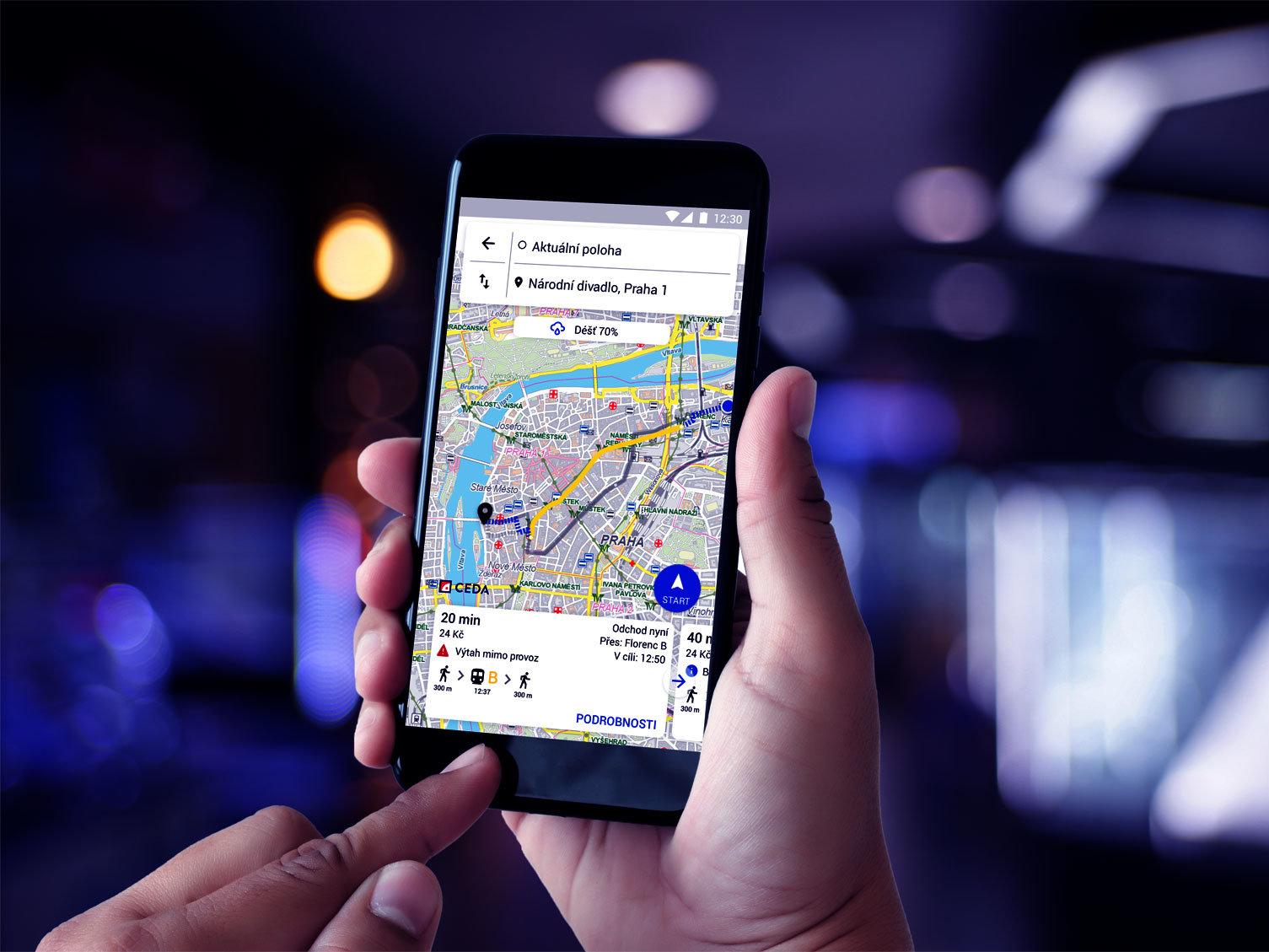
Comprehensive road chart and detailed agenda maps
We will supply you with a detailed map describing in detail all roads and their possible transfer points. We are able to link up information about public transport stops, parking places, traffic signs, charging points and cycle stands with locations of wheelchair barriers as well as blind orientation elements.
- Easy transport information exchange between various agenda and information systems deployed across the region including the National Traffic Information Center and the Integrated Rescue System
- All transport networks are connected in a single chart
- Link parking, charging, public transport and accessibility data
- Route planning and accessibility calculations for pedestrians, cyclists, public transport, rescue services, passenger cars and trucks, supplies, taxi as well as combinations
State-of-the-art mapping systems
Our 3D mapping technology surveys roads, walkways and traffic routes. After that, artificial intelligence acquires all the important information for management and maintenance, technical maps, agendas, navigation or autonomous driving.
- High-quality panoramic photos and point clouds with centimeter accuracy
- Efficient surveying of trees, masts and other elements using artificial intelligence
- Road surface imaging, 3D surface modeling
- Surface quality and road gradient mapping to support navigation maps for the disabled

Custom maps and data for every project
We provide the maps and spatial data you need for your project. For instance, we can map floodplains, ATM networks or billboards along freeways.
- Contracting third-party data and their provisioning under a single license
- Collection and linking data and maps to enable their easy use
- We keep all the data updated at required interval
- We also take care of a way to amend non-existing datasets required for a project

Parking and charging station mapping
We will map parking spaces in garages, rest areas and parking lots on the street. Add pricing and restriction details and link the data with maps. And also enable searching for available parking.
- Parking capacity descriptions including the ability to filter by vehicle type or by authorization
- Parking data distribution to transport centers, car makers and apps
- Improved efficiency and accelerated searching for available parking
- Collection and distribution of online information about parking occupancy regardless of technology used
- Employ parking big data to support parking detection

Building maps and virtual tours
We will map your buildings in detail to create mapping data or virtual tours.
- Interior and floor mapping and navigation
- Compelling and interactive virtual tours to give a detailed overview of a building
- POI database (stores, services...) including details
- Capture barriers and landmarks to support navigation for the disabled
- Capture data for passporting and to document reconstruction or restructuring efforts