Ultra HD Mobile Mapping.
Innovative technology for fast and accurate collection of 3D geodata for effective infrastructure management, planning, and digital twin creation.
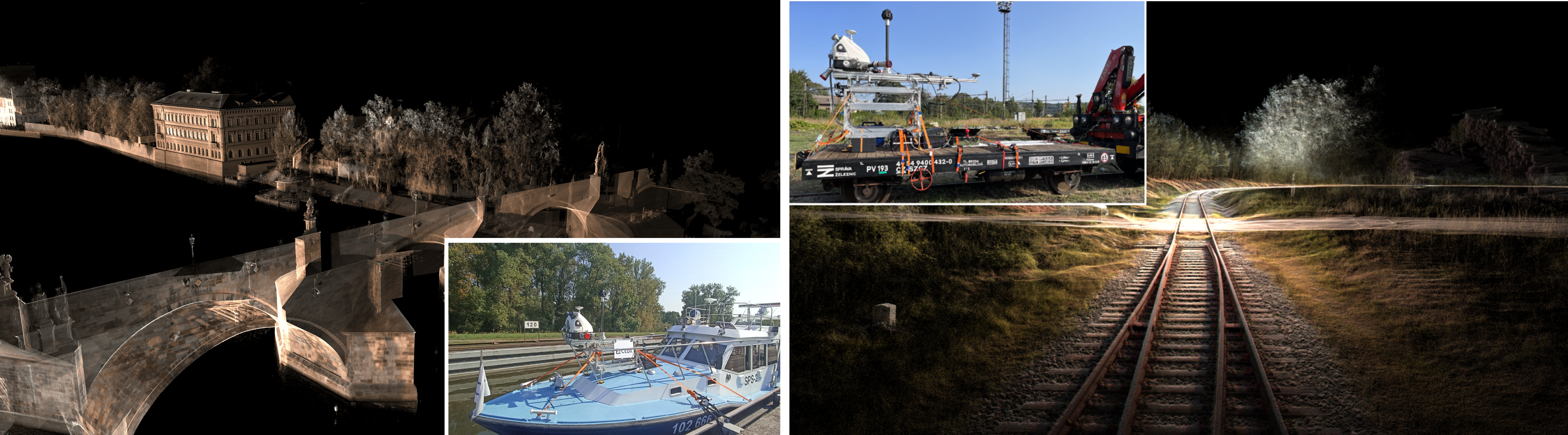
Mobile mapping across diverse environments
Consistent data quality across all environments
Reliable data in both urban environments and along linear infrastructure.Fast, efficient data capture with the accuracy you need
Workflows optimized for different project types and scales.Complete 3D data of infrastructure
A unified dataset covering roads, railways, bridges, and other assets.
Flexible technology deployment
A methodology tailored to project conditions and specific requirements.Reduced need for repeat surveys
Complete and detailed data captured in a single pass.Safe data collection without traffic disruption
Avoids the risks of traditional static surveying methods.
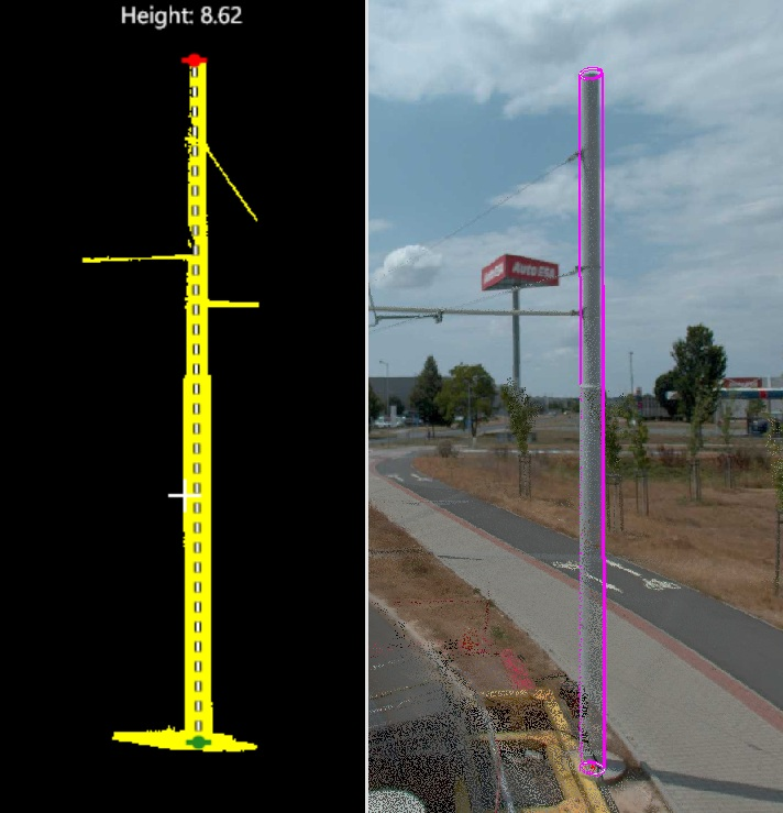
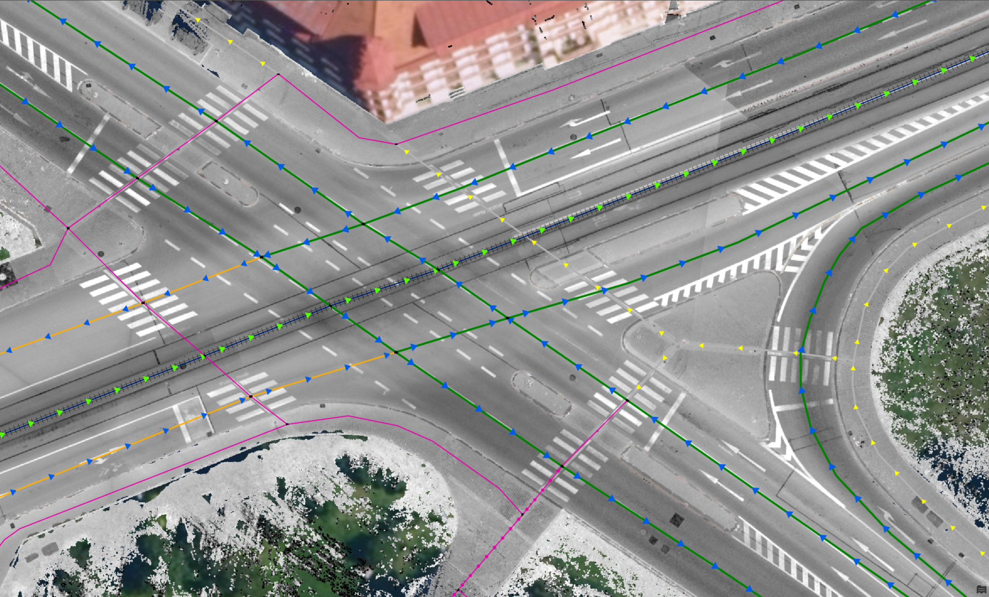
3D object extraction
From point clouds to precise 3D objects.
Automated object extraction from point clouds
Efficient identification and separation of individual infrastructure elements.High geometric accuracy and detail
Centimeter level accuracy suitable for engineering and design applications.
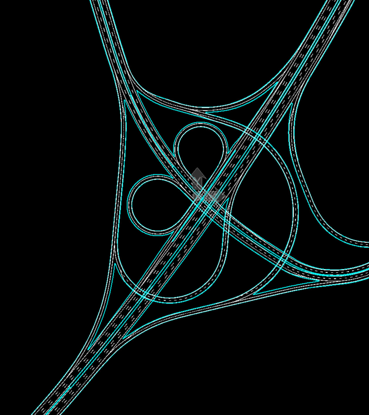
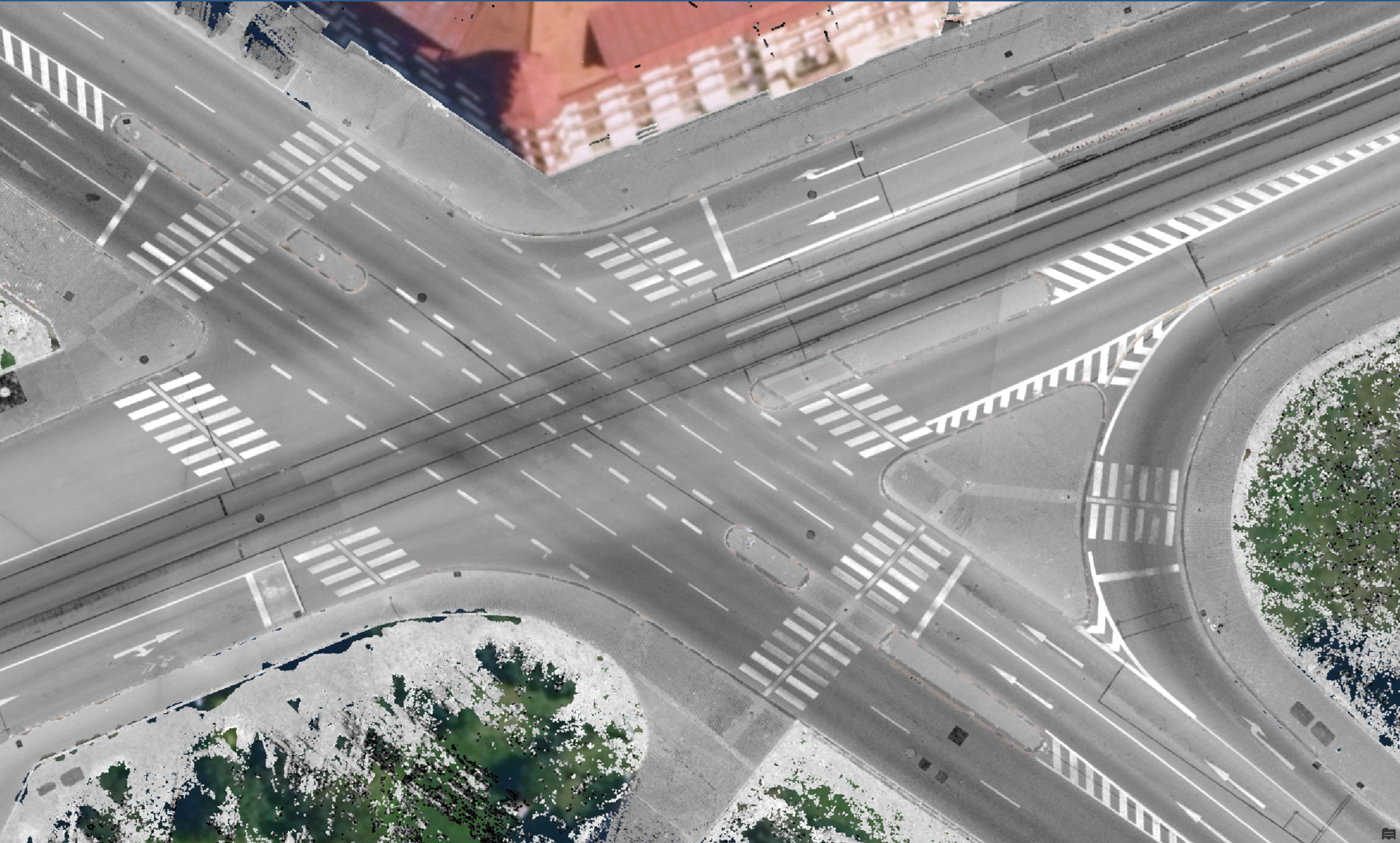
Complex networks with precise 3D geometry.
Captures a wide range of transport infrastructure elements
Road surfaces, curbs, guardrails, bridges, traffic signs, and more.3D outputs ready for GIS, CAD, and BIM
Compatible with commonly used software platforms.Structured data with rich attribute information
Ready for integration with asset management systems and databases.
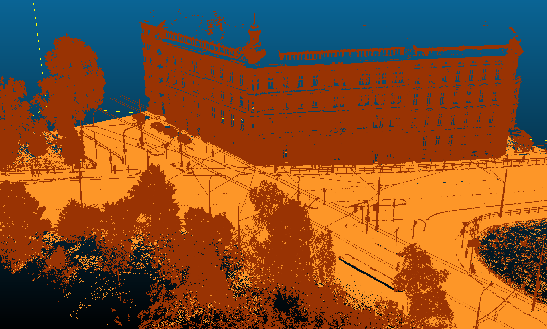
Optimized map layers
Ideal for analysis and decision making
Well suited for infrastructure management, planning and monitoring.Reduced storage and data transfer requirements
Lower costs for data storage, backup, and data transfer.- Easy sharing across your organization
Simple data delivery without the need to handle raw point clouds.
- Optimized for large scale infrastructure projects
Suitable for extensive linear infrastructure such as roads and railways.
Ready for immediate use in GIS and web applications
Standard raster formats supported across GIS and web services.Easy publishing via WMS services
PDirect integration into map portals and other applications.Significant data volume reduction
Point clouds reduced to a few megabytes without losing key information.Preserving key information from 3D data
Heights, intensity values, and orthographic views in a simple 2D format.
Mobile mapping in practice
Reference

"CEDA Maps helped us map sections of the Elbe–Vltava waterway using a mobile mapping system. High resolution 360° panoramic imagery enabled efficient digitalization of waterways and improved the accuracy of geospatial data related to navigation structures."
Tomáš Stanovský, Geographic Information Systems Specialist, State Navigation Authority
Looking for accurate and reliable data?
Get in touch and we’ll design the right mobile mapping solution for your project.